UK Route Guides – Get Inspired & Get Outside
Discover great outdoor activity ideas and detailed uk route guides from OS Maps to follow. Inspiration for finding new UK hiking routes, running trails, cycling routes and even your next paddle adventure.
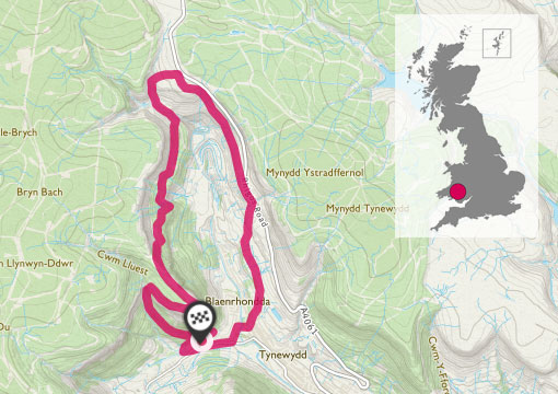
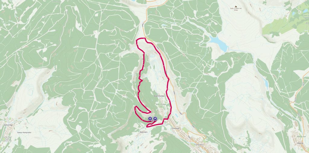
Circular walk around Pen-Pych Mountain
Pen-pych sits at the head of the Rhondda Fawr Valley in South Wales, Rhondda Valley’s very own Table Mountain. Experience the spectacular views of Pen-pych circular walk. This is such a varied walk, which is steeped in history. It passes by some large dramatic waterfalls, two of which are Nant Carnfoesan and Nant Melyn. You can visit an Iron Age settlement of hut circles, views of a former colliery and an old disused railway tunnel.
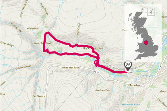
Piper Holes, Marsden
Piper holes provides a gentle 3-mile walk to the head of the Colne Valley. It provides some fantastic views across the wild and rugged landscape of the Marsden Moors and passes the historic Stanedge canal tunnels. It is well sign posted with Marsden Walkers are Welcome signs.
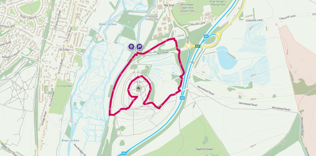
St Catherine’s Hill, Winchester
Topped with the remains of an iron-age fort, this short walk just outside Winchester gives great views across the area.
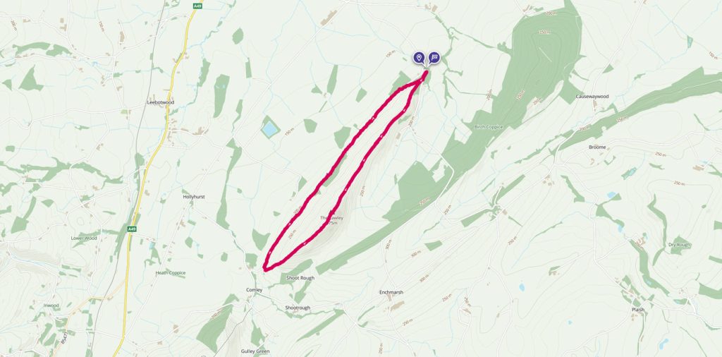
The Lawley Circular Hike
The Lawley is part of the Shropshire Hills range in an area of outstanding natural beauty. The Lawley is one of the smaller hills, standing next to its big brother, Caer Caradoc. It’s an interesting walk, as along the ridge there are remains of an ancient settlement and hill fort.
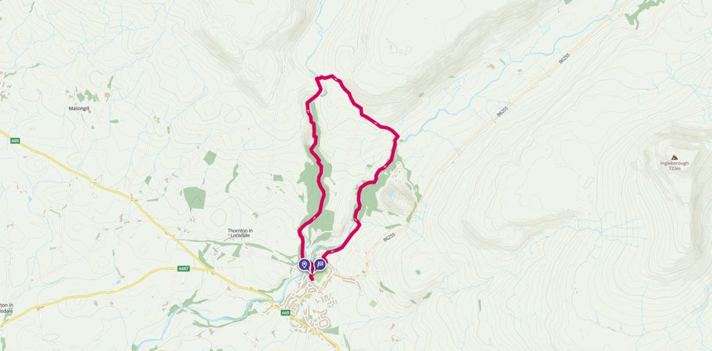
Tourist trail at Ingleton Waterfalls
The Yorkshire Dales are awash with rolling hills and beautiful walking routes. If you have time for just one walk when you are in the area, you would do well to head to the Ingleton Waterfalls Trail.
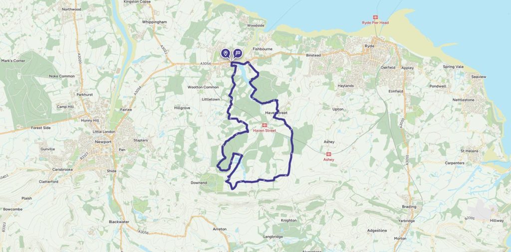
Discovering bluebell woods with the Isle of Wight Walking Festival
Discovering bluebell woods with the spring Isle of Wight Walking Festival – an ideal spring walking route on this traditional holiday destination.
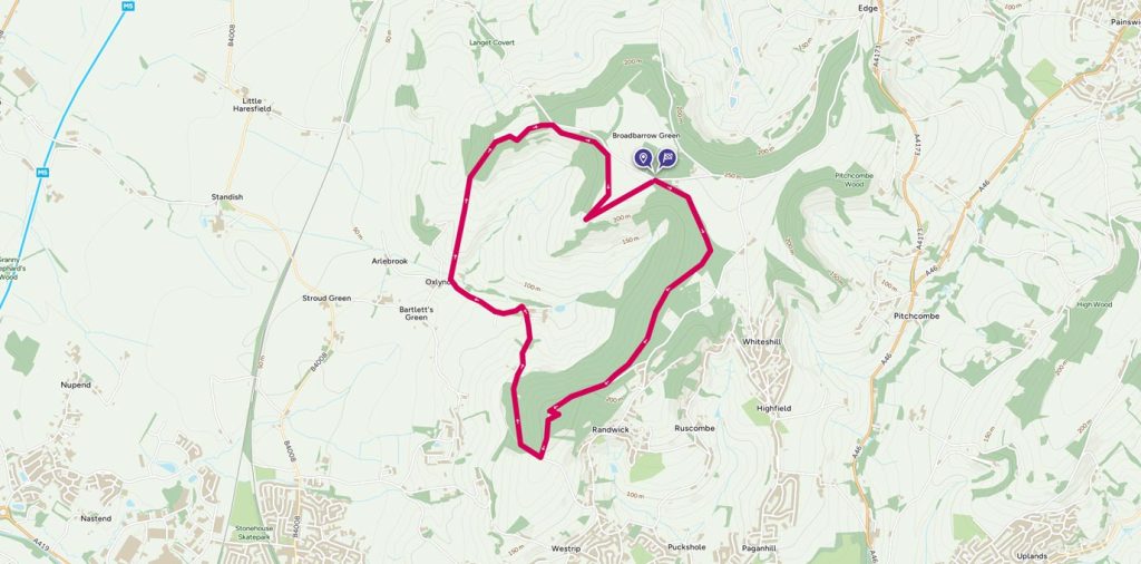
Discovering history around Haresfield Beacon
Haresfield Beacon in the Cotswolds gives glorious views over the River Severn all the way to the Black Mountains in Wales and offers a profusion of wildlife and historic sites.Follow this walking route from Seren Wildwood.
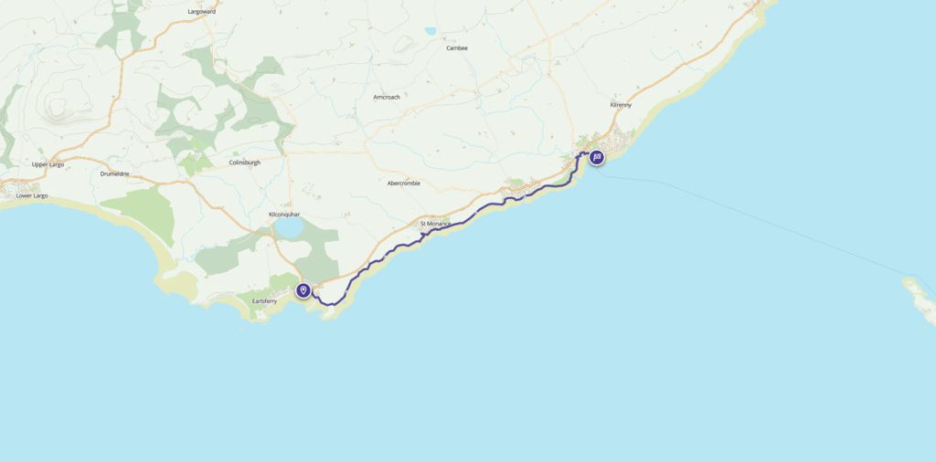
Elie to Anstruther: an afternoon stroll
This walk from Elie to Anstruther is a great for a sunny afternoon with refreshments along the way.
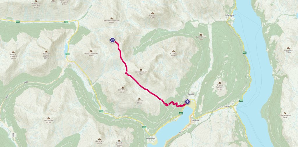
Munro bagging: Beinn Ime
Start exploring the Munros with this 9 mile walk around the highest point, Beinn Ime.