UK Route Guides – Get Inspired & Get Outside
Discover great outdoor activity ideas and detailed uk route guides from OS Maps to follow. Inspiration for finding new UK hiking routes, running trails, cycling routes and even your next paddle adventure.
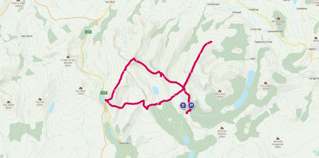
A 34km Special Forces trek in the Brecon Beacons
A serious challenge, trig 642 is, despite its modest height, quite possibly one of the most demanding trig pillars to bag, if you stay true to the way it would be reached if you were on Special Forces ‘Selection’.
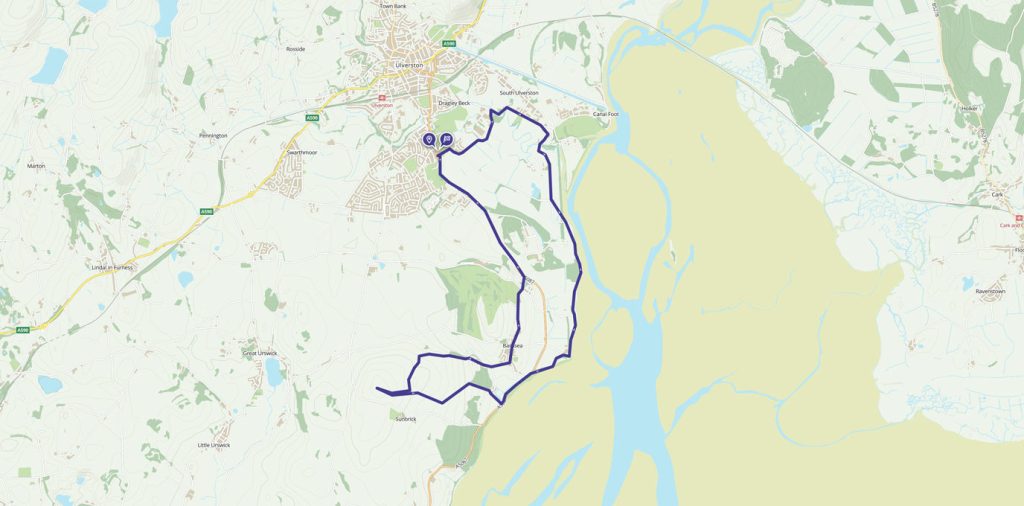
A coastal loop of Ulverston with stunning views
This walk has a little of everything, from country lanes, beautiful views across Morecambe Bay, and a gradual climb to Brigg Common for a 360 degree view of the sea and the Lake District.
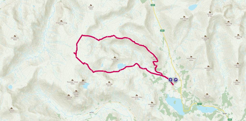
A High Raise round from Grasmere
A walk from Grasmere up to the High Raise summit and trig pillar, the highest point in the Central Fells with commanding views of the whole Lake District.
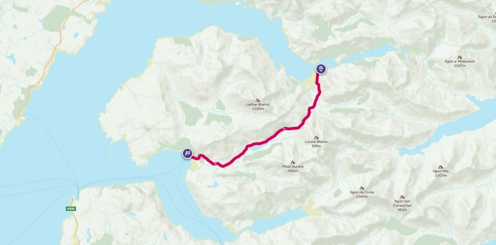
A pint too far? Unforgetable walk from Loch Nevis to Loch Hourn
How far would you walk for a pint? Follow Phoebe Smith on this unforgetable walk from Loch Nevis to Loch Hourn
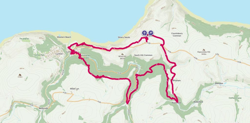
Coastal views and cascading rivers on Exmoor
This circular coastal walk includes wild, expansive moorland steep-sided wooded valleys and a rugged coastline with high cliffs, hidden coves and secluded beaches.
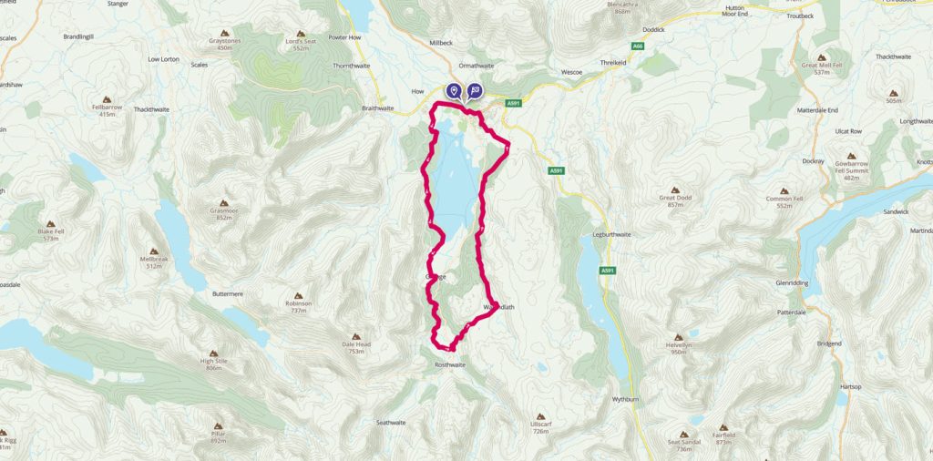
Dodging floods on a Derwent Water circular walk
Derwent Water is one of the most picturesque areas of the Lake District, but at the time I went I had to carefully plan a route to avoid recent flood damage.
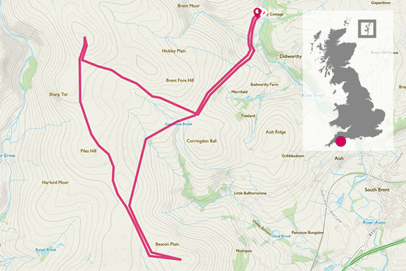
Eternal peace and quiet with a walk to Three Barrows
This Dartmoor National Park route is full of interest and when you reach Three Barrows, you’ll find a peaceful spot; it is easy to see why Bronze Age man chose to spend eternity there!
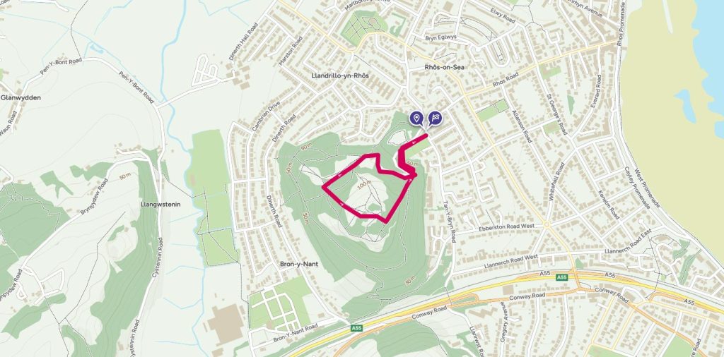
Exploring the Iron Age hill fort at Bryn Euryn
A circular walk to Bryn Euryn where you’ll climb through woodland and discover the impressions in the grass of an Iron Age hill fort and bag a trig pillar.
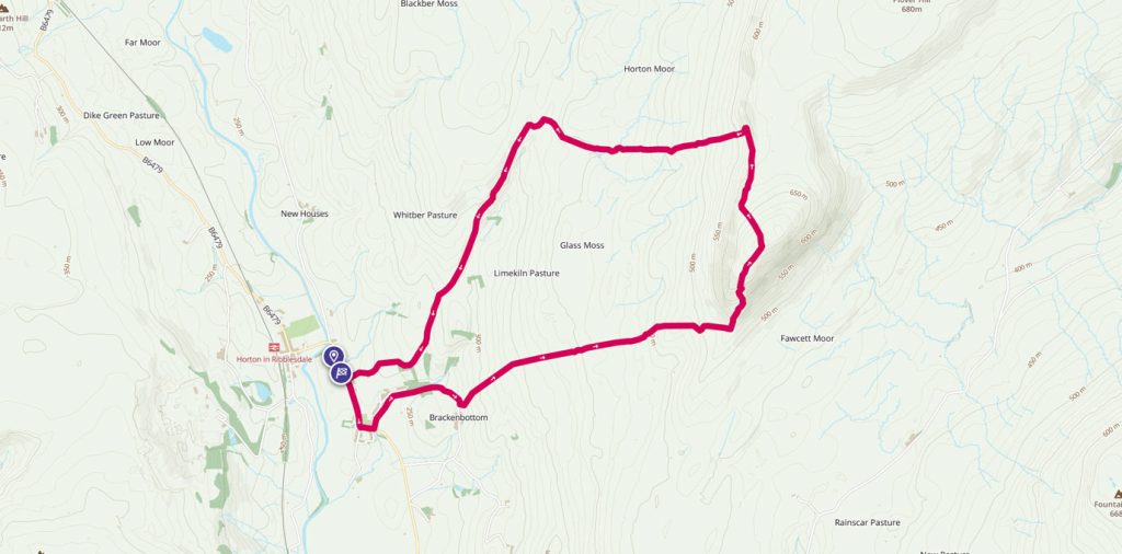
Pen-y-ghent – a mountain of a hill that will give the family ‘summit’ to remember
Pen-y-ghent is the perfect hill with which to give young children a taste of an outdoor challenge. The circular walk to the summit from Horton-in-Ribblesdale is under six miles – perfect for little legs or when the days are short and time is squeezed.