UK Route Guides – Get Inspired & Get Outside
Discover great outdoor activity ideas and detailed uk route guides from OS Maps to follow. Inspiration for finding new UK hiking routes, running trails, cycling routes and even your next paddle adventure.
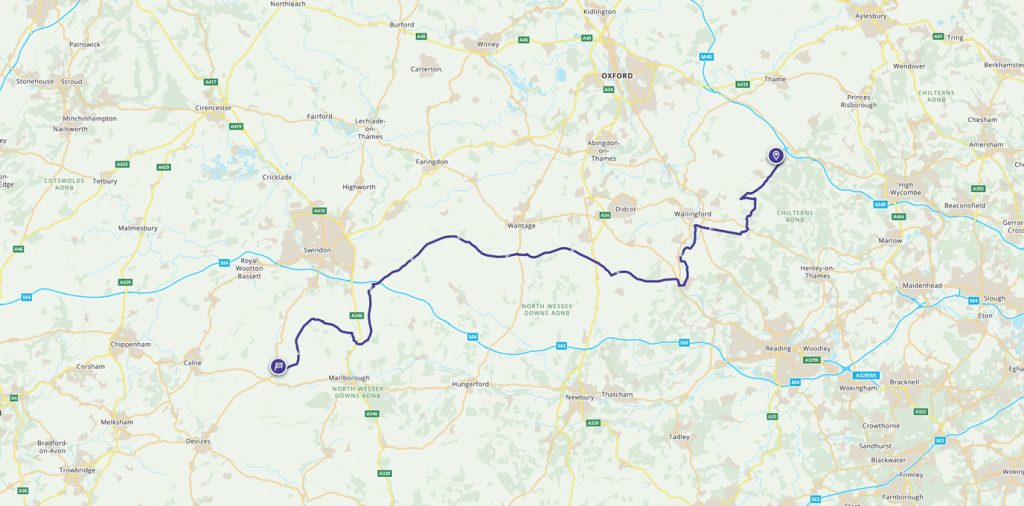
Race to the Stones 100km ultra marathon
The Race to the Stones is 100km along one of the oldest trails in Britain – The Ridgeway. Trail runner and OS CEO Nigel Clifford found out how tough it can be.
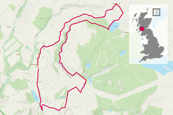
Running rings round Doughnot Hill
Take in the trig point on top of the brilliantly named Doughnot Hill in the Kilpatrick Hills north of Glasgow.
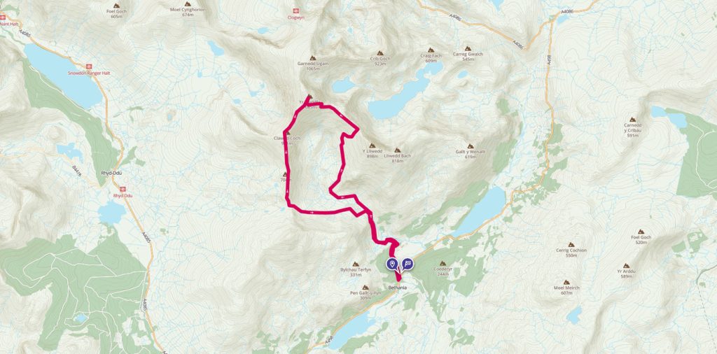
Tackling the Snowdon Summit via the Watkin Path and South Ridge
Get the sense of adventure and solitude and see many aspects of Snowdon across the day. You’ll see amazing waterfalls, rocks, old settlements, ridge lines and of course, the famous summit trig pillar!
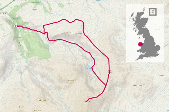
Trig bagging at Foel Fras and Cwm Anafon
Tackling one of Wales’ 15 big peaks with views across Snowdonia, Anglesey and Liverpool Bay from the Foel Fras trig pillar.
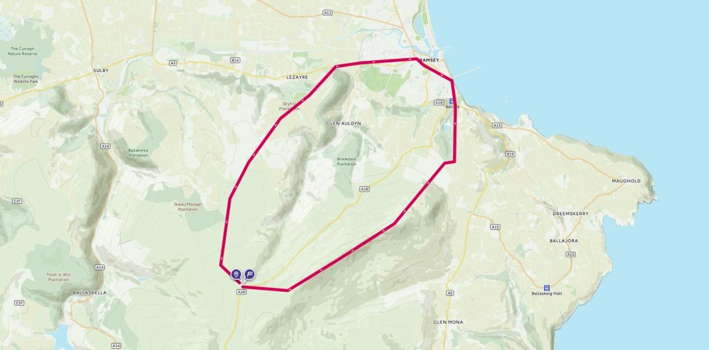
Trig bagging on the Isle of Man
The North Barrule trig pillar is on the Isle of Man and is at the end of a lovely ridge with many false summits.
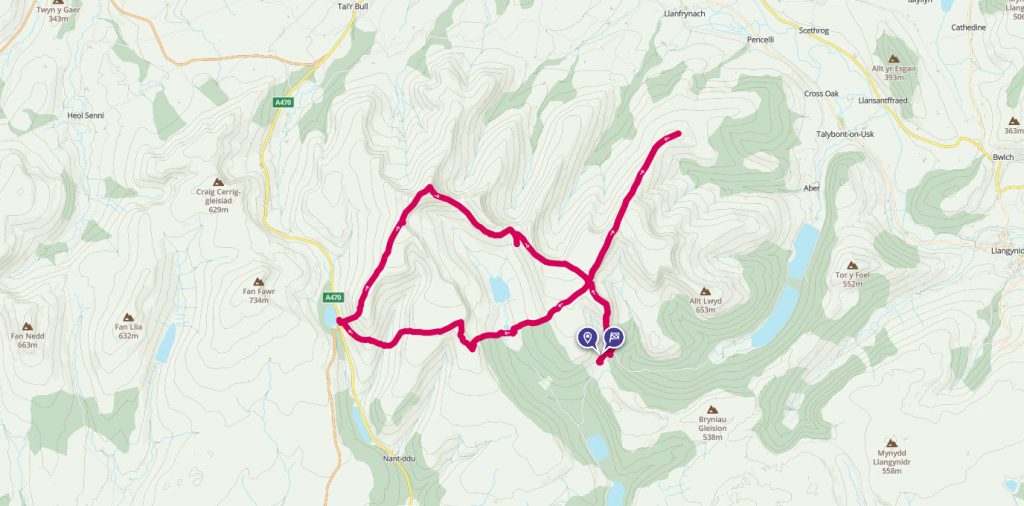
A 34km Special Forces trek in the Brecon Beacons
A serious challenge, trig 642 is, despite its modest height, quite possibly one of the most demanding trig pillars to bag, if you stay true to the way it would be reached if you were on Special Forces ‘Selection’.
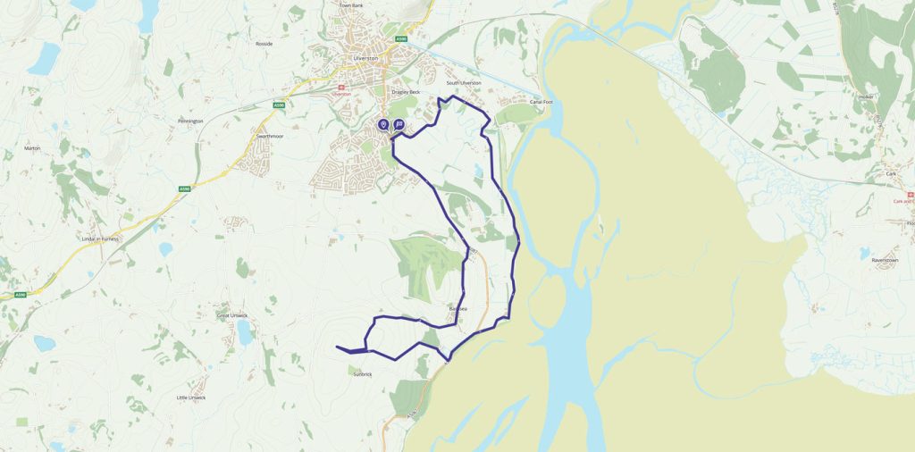
A coastal loop of Ulverston with stunning views
This walk has a little of everything, from country lanes, beautiful views across Morecambe Bay, and a gradual climb to Brigg Common for a 360 degree view of the sea and the Lake District.
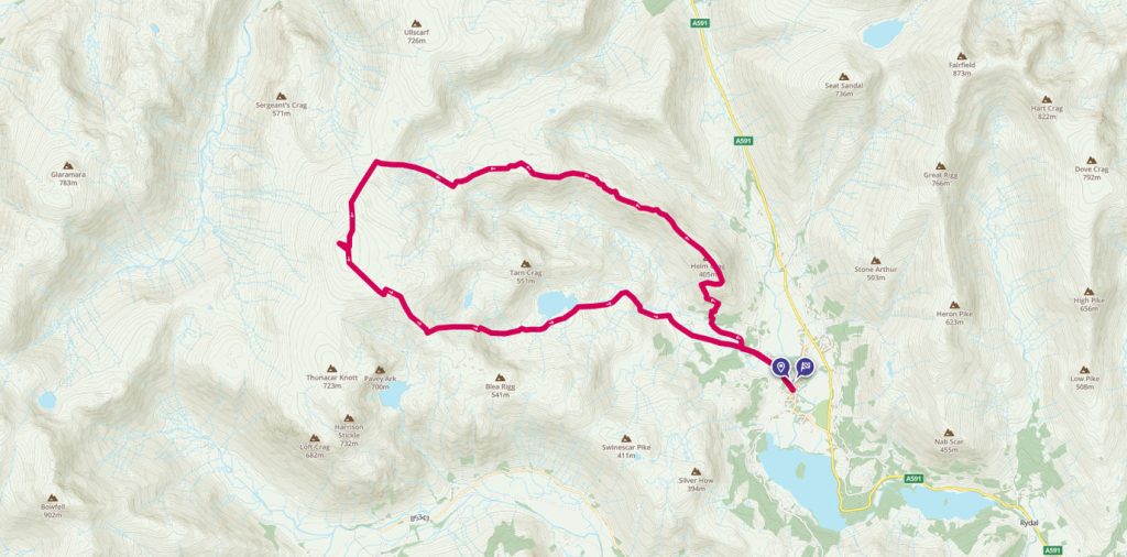
A High Raise round from Grasmere
A walk from Grasmere up to the High Raise summit and trig pillar, the highest point in the Central Fells with commanding views of the whole Lake District.
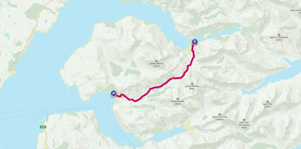
A pint too far? Unforgetable walk from Loch Nevis to Loch Hourn
How far would you walk for a pint? Follow Phoebe Smith on this unforgetable walk from Loch Nevis to Loch Hourn