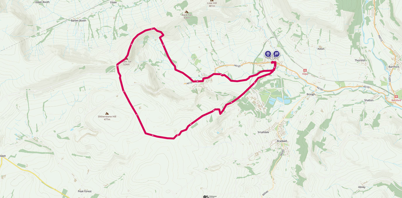
Perfect as a walk or run and great for families, this Peak District route is easy to follow with stunning views from the popular Mam Tor.
SK 171 835
Park in Hope in either the car park, or more often than not, you will be able to find some space on a road somewhere.
This walk starts on the road and takes you past the famous cement works, here you will see the factory from a variety of views so you can make your mind up if you like it or not. I personally don’t think of it as a blemish on the landscape but almost enhancing what is around it. Having something so industrial surrounded by only natural beauty in my eyes exaggerates both parts and makes them both stand out for what they are worth.
4.2 km
As you climb higher and begin to leave the quarry behind notice the landscape change, you are now in lowland moor country, look out for pheasants and if you are lucky enough you might even spot the quick flash of a hare.
As you begin to walk north the peaks in front of you are ones you will be at the top of before you know it. The path from here is extremely straight forward and even sign posted!
6.5 km
After crossing over the road take a look to your right, here you will see an unusual rock formation known as Windy Knoll, this area is loved by geologists and makes a perfect picnic spot. If you have little ones with you this is a brilliant area for a bit of scrambling and exploring.


7.6 km
Next stop is the top of Mam Tor, however keep your eyes peeled as the level plateau at the top makes a perfect run off for paragliders, on a sunny day the sky will be scattered with what looks to be birds but on closer inspection they are gliders getting a completely different perspective on their surroundings. If you are lucky enough to be at the top when someone is launching check out how big their bag is, at least you haven’t got to carry that much!!
9 km
Now it is a case of just sticking to the path and heading to the next peak, the next one is Hollins Cross and after that is all downhill back to the car. Make the most of the 360 views along this ridge path, I hope it is sunny for you, as in the summer I think it is one of the most stunning landscapes out there…I suppose I am biased!
Once at Hollins Cross it is just a case of following the footpath down in to Castleton, again this is very simple and signposted. If it is clear you will be even be able to see where you are heading.
11.4 km
Cake stop time!!! Castleton is a brilliant little place, every shop, café, pub, tourist venue welcomes walkers and mostly dogs so don’t worry about what you are wearing just make the most of your time here. There is always lots going on but gets extremely busy in summer, head to the tourist information centre for free toilets, a huge carpark and cheap and cheerful cups of tea. A little stream runs alongside the large carpark here and on hot days you will find plenty of visitors cooling their feet and dogs taking the opportunity for a quick paddle. On the other side of the mini roundabout you will find little shop serving the most delish locally made ice cream, however if it is cake you want you really are spoilt for choice!
Follow the main street through the village signposted for Hope but take the opportunity to pop in the quirky little shops, art galleries and cafes that line the route.
11.9 km
The last part of this walk picks its way across the fields back to Hope. This is my favourite part to run and a path that makes me forget the tiredness in my legs and just enjoy running. It is 2km of rivers to follow, sheep to dodge, stiles to hop over and always puts a smile on my face. I purposely leave this until the end as I know it will only cheer me up and spur me on. Go and see for yourself!
14.2 km SK 170 834
14 km / 9 miles


