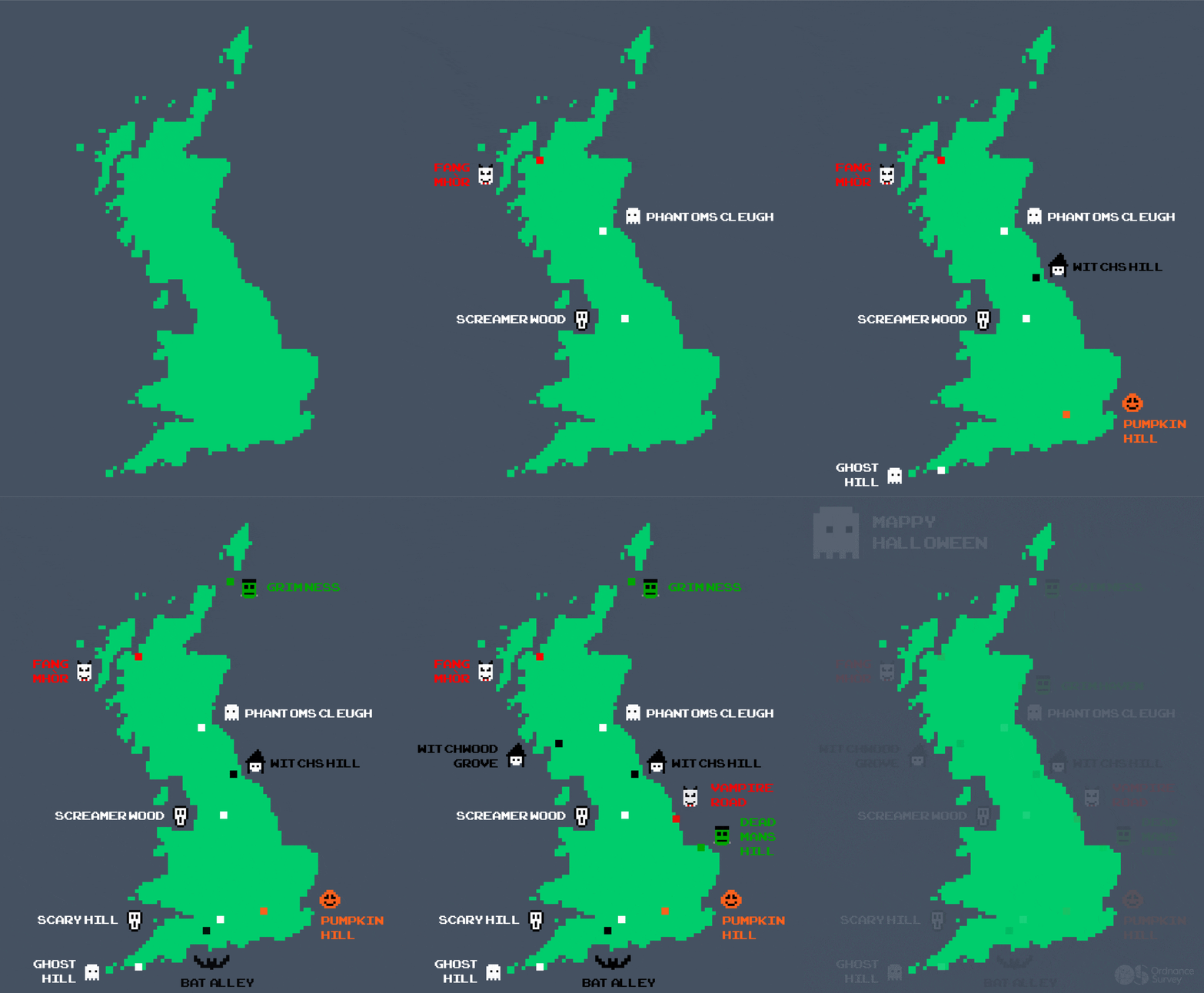
For Halloween, we’ve dug out 38 of the spookiest place names we can find across the UK… can you add any more?
- Bat Alley, Pleck, Dorset
- Tom na Bat Hill, Cairngorms
- Gallions Wood, South Bucks
- Hallows Grove, Bradford
- All Hallows Drive, Rotherham
- Hallowed Lands, Harpswell
- Pumpkin Park, Bedfordshire
- Pumpkin Hill, South Bucks
- Hanged Man, Dumfries & Galloway
- Broomstick Lane, Botley
- The Tomb, South Hams
- Fright Wood, Canterbury
- Scary Cleugh, Northumberland
- Scary Hill, Vale of the White Horse
- Grim Haven, Aberdeenshire
- Grue Copse, Mid Devon
- Howl Moor, Scarborough
- Screamer Wood, Bradley
- Scream Point, Kendal
- Dark Peak, Peak District – 3 of the best local walks

Plus there’s all these scary monster names too…
- Little Lumpkid, near Hadleigh
- Mouster Head, Orkney
- Witch Crags, Northumberland National Park
- Witch Hill Plantation, Havering, London
- Spook Hill, North Holmwood
- Ghost Copse, near Folkestone
- Ghost Hill, Cornwall
- Deamon Street, Bolsover
- Dead Man’s Hill, Norfolk
- Phantom’s Cleugh, Edinburgh
- Goblin Hill, Devon
- Goblin Ledge, Goucestershire
- Devil’s Lane, Liphook
- Devil’s Dyke, South Downs – walking trails
- Vampire Way, Farnborough
- Vampire Road, Manby
- Warlock Close, Southampton
- Hangman’s Hill, County of Herefordshire


Do you know of anymore spooky place names? Comment below and let us know!
Get outside this Halloween and give yourself an authentic fright night experience with these top walks around the spookiest places in the UK, suitable for the whole family!


