Improve your map reading skills
Have you ever got confused about what a map scale is, or wondered what is the difference between our OS Landranger and OS Explorer maps? This beginner’s guide to understanding map scales will help! Includes a short video for easier learning.
Choosing the right map scale can be really important when you are planning you adventures. Use a map with too little detail and it can be hard to use, while too detailed a map may mean you are continually going off the page or map sheet. The critical item that tells you how much detail is shown is called the ‘scale’. That’s why some of our most popular maps, the OS Explorer and OS Landranger are often used for different activities – both have different map scales.
What is a map scale?
The scale of a map shows how much you would have to enlarge your map to get the actual size of the piece of land you are looking at. For example, if the scale on a map is 1:25 000, that means that every 1cm on the map represents 25 000 of those same units of measurement on the ground (for example, 25 000cm = 250 metres). That might sound a bit complicated, but OS maps have been designed to make understanding scale easy. Look at the front of a 1:25 000 scale map and you will see that the scale has been also written out for you like this:
4cm to 1km
This means that every 4cm on a map = 1km in real life. To make it even easier, the grid lines are exactly 4cm apart, so every square is 1km by 1km.
Maps are made at different scales for different purposes. The 1:25 000 scale map is very useful for walking, but if you use it in a car you will quickly drive off the edge! On the other hand, maps at 1:250 000 scale (note the extra zero) show lots more area, but in far less detail.

What is a map scale?
A map scale is the size ratio of a feature on the map to the one in the real world
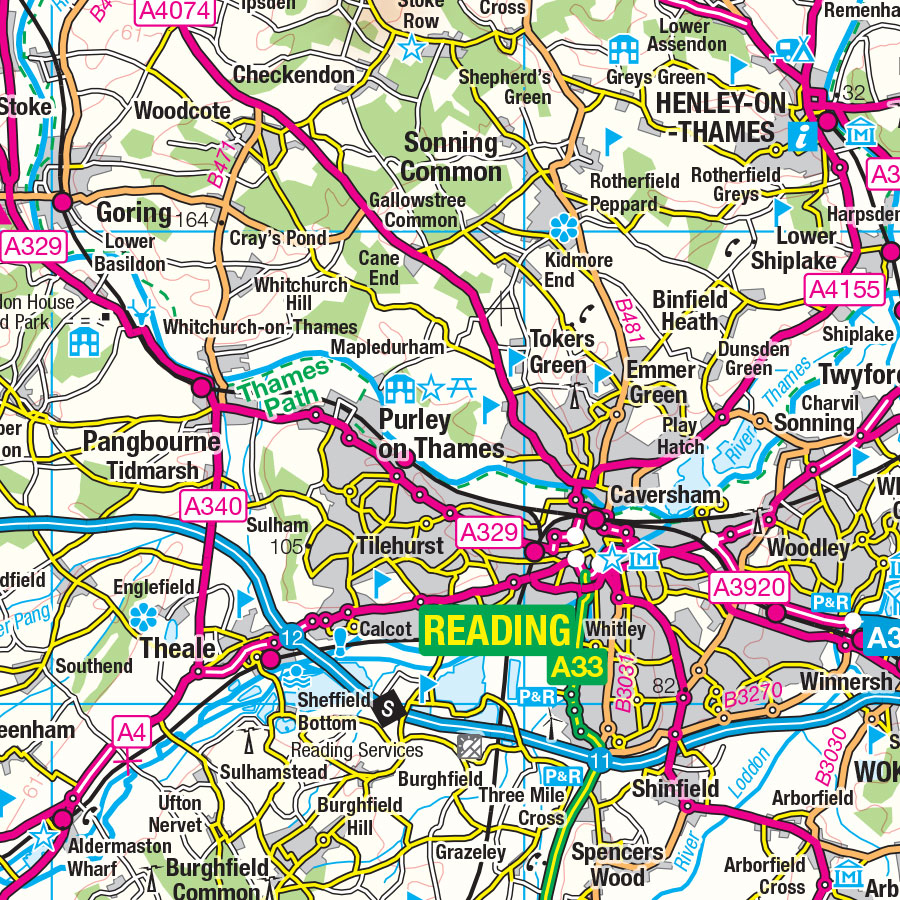
Example of 1: 250 000 scale mapping, showing roads but few other features and ideal for driving
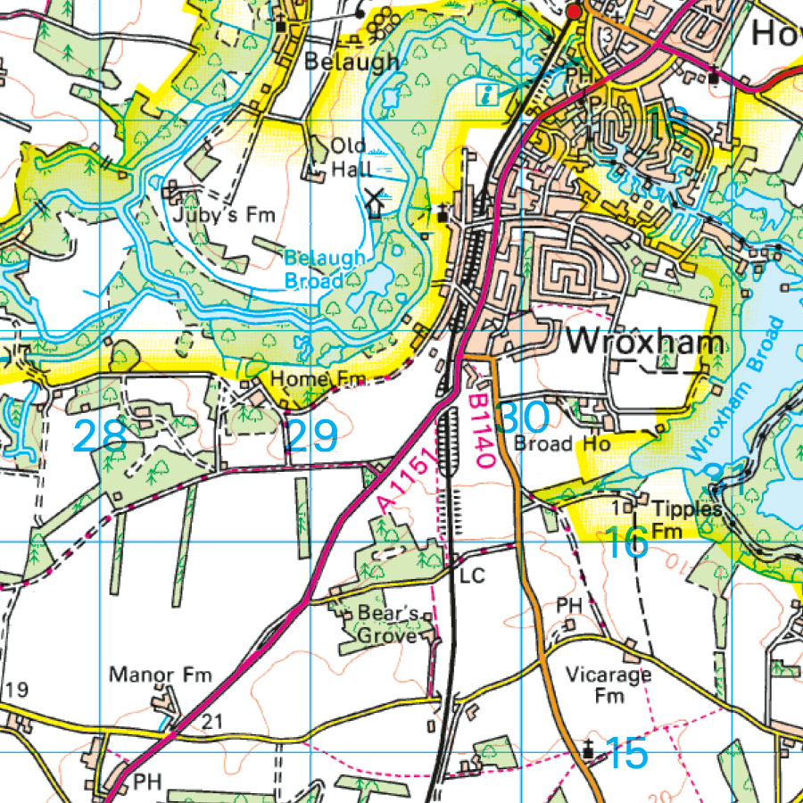
Example of 1: 50 000 scale mapping with road and some other features for cycling and holidays
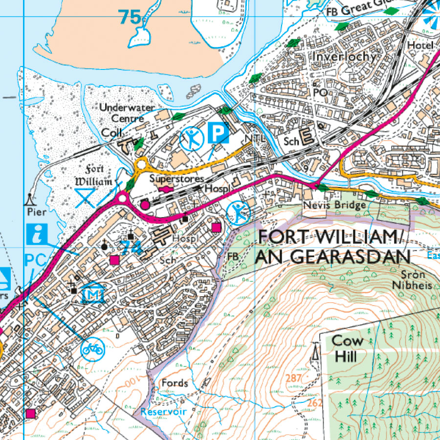
Example of 1: 25 000 scale mapping shows most paths and individual buildings with enough details for walking and MTB
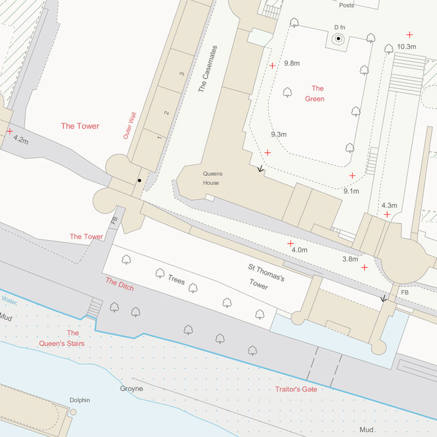
Example of 1: 1250 scale mapping showing a small area, normally used for building and construction
Popular OS map scales
OS Road Maps: 1: 250 000 scale, shows roads and towns, but few individual features over a large area
OS Tour Maps: 1: 100 000 scale, shows an overview of road, rail and sea connections plus tourism features for extended trips. GB Tour Map is 1: 550 000 scale.
OS Landranger Maps: 1 : 50 000 scale, shows roads, large paths and some individual features
OS Explorer Maps: 1 : 25 000 scale, shows many features including paths and buildings over a small area
OS MasterMap: 1: 1 250 scale, shows accurate position for individual buildings or small areas
Map scales explained by Steve Backshall
Large map scale vs small map scale
The terms ‘large scale’ and ‘small scale’ are used to describe different scales. However, they can be confusing :
Large scale maps have low number is the scale, such as 1: 1250. The features are shown are large
Small scale maps have a high number in the scale, such as 1: 250 000. Individual features shown are small
High number = small scale
There is no fixed definition of what scale ratios fall into large scale or small scale.
OS Maps app
The OS Maps app and web version allows you to switch between multiple map scales with a Premium subscription so you have access instant access to all 607 OS Leisure maps. You can also lock both 1:25 000 (OS Explorer map) and 1:50 000 (OS Landranger map) scales to best suit your chosen activity.
For more help with navigating when out and about, check out our Pathfinder guide titled Navigation Skills for Walkers including map reading, compass and GPS.


