Discover OS Maps
Plan all your routes and adventures instantly on your digital devices with OS Maps. Create your own routes for walking, running, cycling and more; or choose from millions of ready-made routes.
OS Maps is your digital guide in the great outdoors, with mapping and route planning tools in the palm of your hand; whether you are a walker, runner, cyclist or just want to explore the outdoors!
Key features

Use OS Maps across all your devices
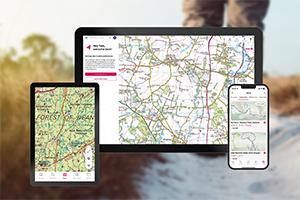
View, create and sync your activities between desktop and mobile.

Global snap-to-path
Just two taps will automatically give you the most enjoyable, accessible and safe route between two points.

Record and follow routes
Plot a route to follow or share – or record your route while you’re out and about.

Offline maps
Download your favourite areas to view offline – so you can view any part of GB even without a mobile signal.


Go further with OS Maps
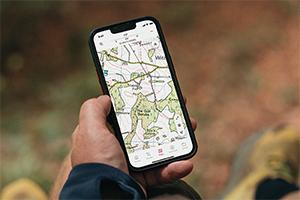
Maps Anytime, Anywhere
Street mapping, high-resolution Aerial imagery and Topographic mapping let’s you explore the world around you and discover new places.
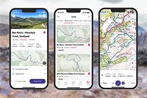
Discover New Adventures
Choose from millions of ready-made routes from other OS Maps users and recommended route suppliers. Find inspiration for walking, running, cycling and more.
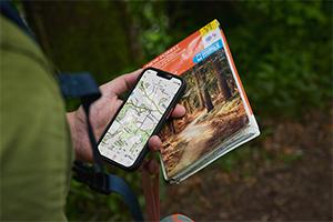
Create Your Own Routes
Plot and follow your own routes. Create unlimited routes, follow them on your mobile and record where you are exploring.

No Signal? No Problem
Download maps and routes to your phone so you can access them directly from your phone whenever you need.
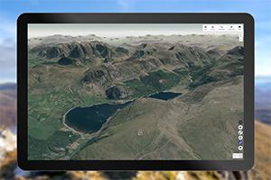
Explore 3D Landscapes
Use OS Maps on web to explore landscapes in stunning 3D, with route-fly-throughs so you can see every step before you head out the door!
Seamless Synching
Works across all your devices. Go from laptop to hill top and everywhere in between with routes and maps synched to your phone.
OS Maps Features
| Feature | Free | Premium |
|---|---|---|
| OS Standard mapping | Y | Y |
| Plot, record and follow routes | Y | Y |
| Use web and mobile | Y | Y |
| View purchased maps offfine | Y | Y |
| Import and export routes | Y | Y |
| Topographic mapping | Y | |
| 3D mapping | Y | |
| Save maps offline | Y | |
| Global snap to path | Y | |
| Print A4/A3 maps | Y |
Get started with these short videos
Getting started with OS Maps
Creating a route
Map types & overlays
Printing a map
Finding a route
Aerial & 3D Fly-Through
Watch a guided tour of OS Maps
What other people are saying
“Excellent walk with kids around Chew Stoke today…very happy with Ordnance Survey iOS app & subscription too.”
@oliverhumpage
“Almost perfect. This app allows me to see the whole of the UK in 1:25000 scale which is perfect I can view other people’s routes and make my own.”
Matt H.
“Fantastic app. Great when I want to take my dogs for a long walk in an area I don’t normally go. Record a route and plot a route are brilliant tools. Thanks OS!”
Pamela E.
“Excellent app. This is a great addition to the OS offering. You buy a map, scratch the code, enter it in the free app and then you have the map on your smartphone.”
David B.

Unlock a Premium Subscription *
Try it for FREE
The OS Maps app is full of fantastic features in a complete, digital map of Great Britain. An invaluable tool when you’re out and about.