UK Route Guides – Get Inspired & Get Outside
Discover great outdoor activity ideas and detailed uk route guides from OS Maps to follow. Inspiration for finding new UK hiking routes, running trails, cycling routes and even your next paddle adventure.
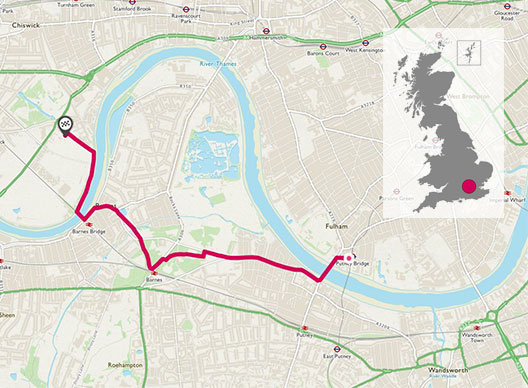
A little Gem in London: Putney, Barnes to Chiswick Markets
A small ponder along green lush woodlands, passing old oak trees and wide open spaces along south of the river where the pace is a bit slower and the wildlife from Jays to Woodpeckers awaits you around the corner.
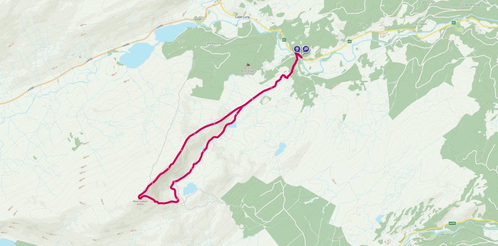
Moel Siabod Circular walk
Follow this medium difficulty walking route up Moel Siabod in Snowdonia with brilliant views from the summit
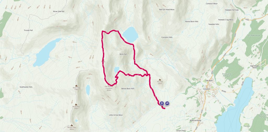
Old Man of Coniston and Levers Water Circular
The Old Man of Coniston is part of the Furness Fells in the Lake District standing 803m high, and lies to the west of the village of Coniston, and Coniston Water. OS GetOutside Champion duo, TwoTravlrs, take us across this underrated beauty of the Lakes.
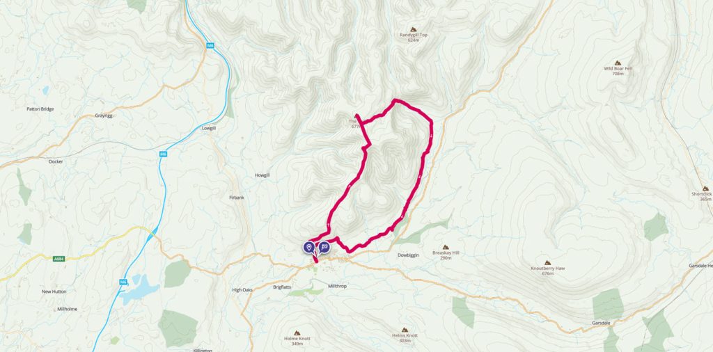
The Howgill Fells
Drive along the M6 motorway between Carlisle and Lancaster and a magnificent mountain range will rise before you. Fells such as Great Gable, Helvellyn, The Langdale Pikes and Scafell Pike will entice you in with their rugged charm. Not far from the Lake District and visible from the same stretch of Motorway lies a small mound of hills. Names such as Winder, Brant Fell and The Calf do not capture the imagination like their loftier neighbours. Having said that, The Howgill Fells are beautiful in their own right and well worth a visit.
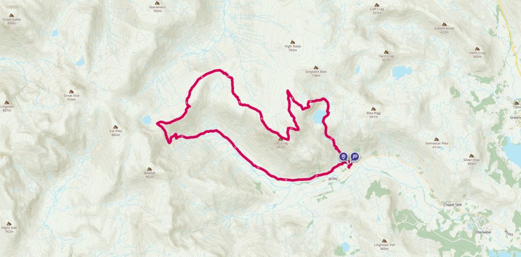
The very best of the Langdale Pikes
James Forrest explores the very best of the Langdale Pikes in a long – but glorious – day of hiking.
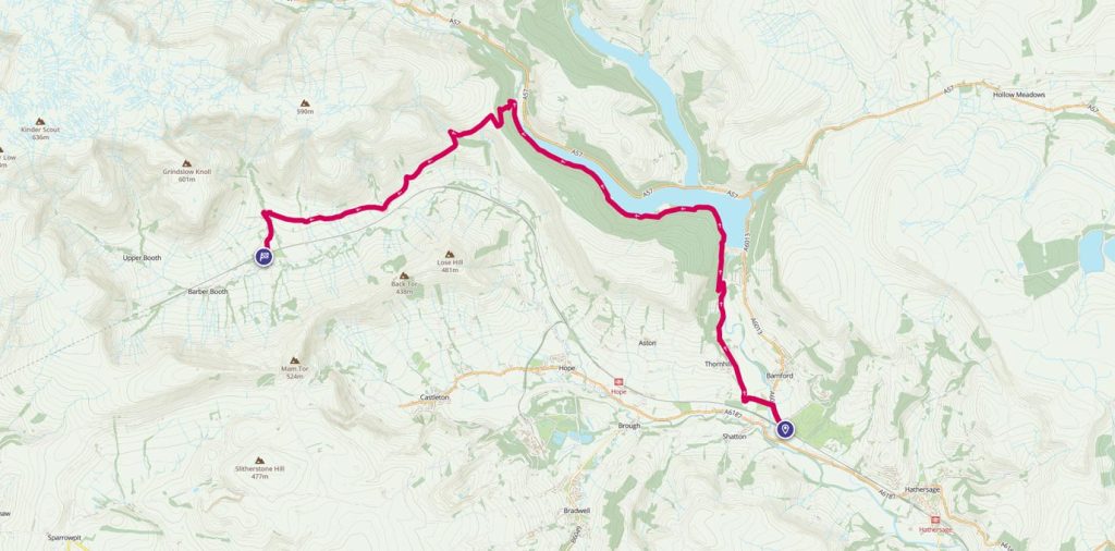
Bamford to Edale, via Ladybower
OS GetOutside Champion team, TwoTravlrs explore Ladybower Reservoir, one of the more popular reservoirs to visit in the Peak District.
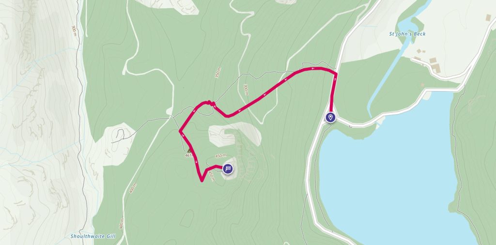
Raven Crag – Thirlmere
OS GetOutside Champion, Jack Anstey, takes us on a short, steep walk with some of the most rewarding and spectacular views the Lake District has to offer.
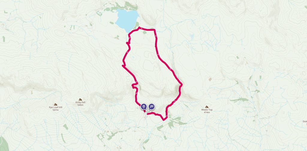
Malham Cove & Gordale Scar
OS GetOutside Champion, Scott McAlister, explores Malham Cove and Gordale Scar in the Yorkshire Dales, voted in at number 3 on ITV’s Britain’s favourite 100 walks.
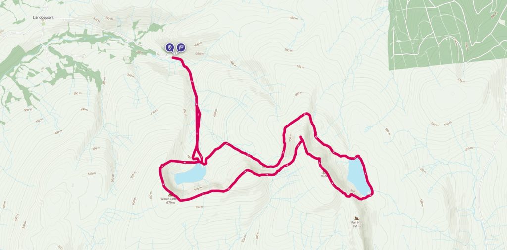
Llyn y Fan Fach and Llyn y Fan Fawr Circular Walk
OS Champion Tracy Purnell takes us on a half day circular walk across Llyn y Fan Fach and Llyn y Fan Fawr in the Brecon Beacons National Park.