UK Route Guides – Get Inspired & Get Outside
Discover great outdoor activity ideas and detailed uk route guides from OS Maps to follow. Inspiration for finding new UK hiking routes, running trails, cycling routes and even your next paddle adventure.
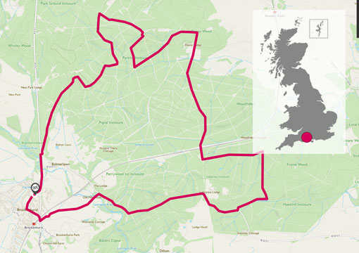
Bike exploring: The New Forest
Brockenhurst New Forest Loop. Just under 12 miles of easy going forest trails and tarmac. A great all year ride, perfect for families. The route starts and stops in the pretty little town of Brockenhurst.
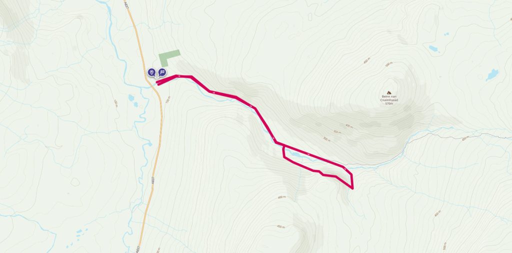
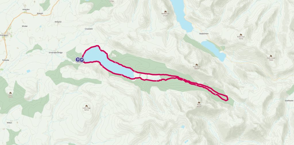
Ennerdale Forest walk
The English Lake District is blessed with some of the finest scenery in the United Kingdom. Instead of going for the peaks, for this walk we’ve chosen to explore the Ennerdale Valley
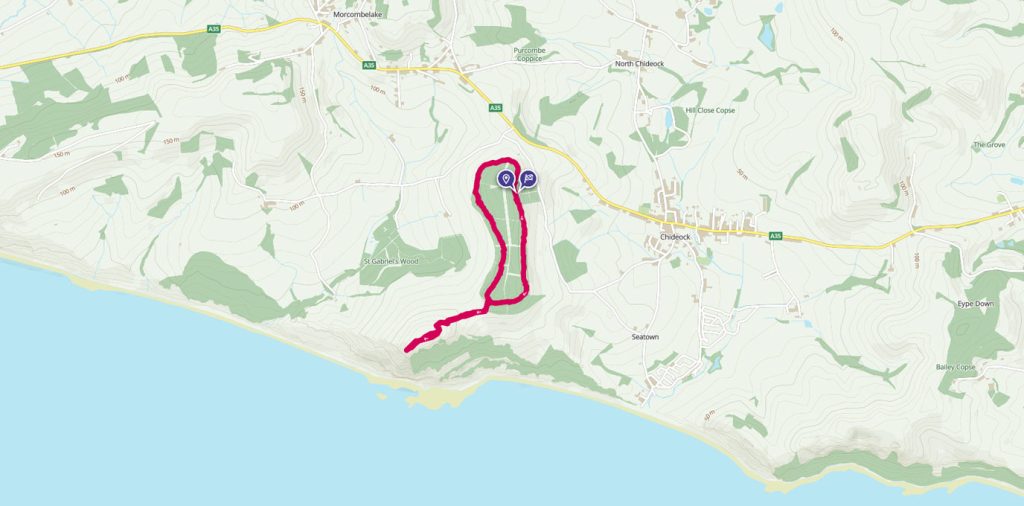
Jurassic Coast Golden Cap walk
Discover what’s Golden about the Jurassic Coast’s ultimate view point
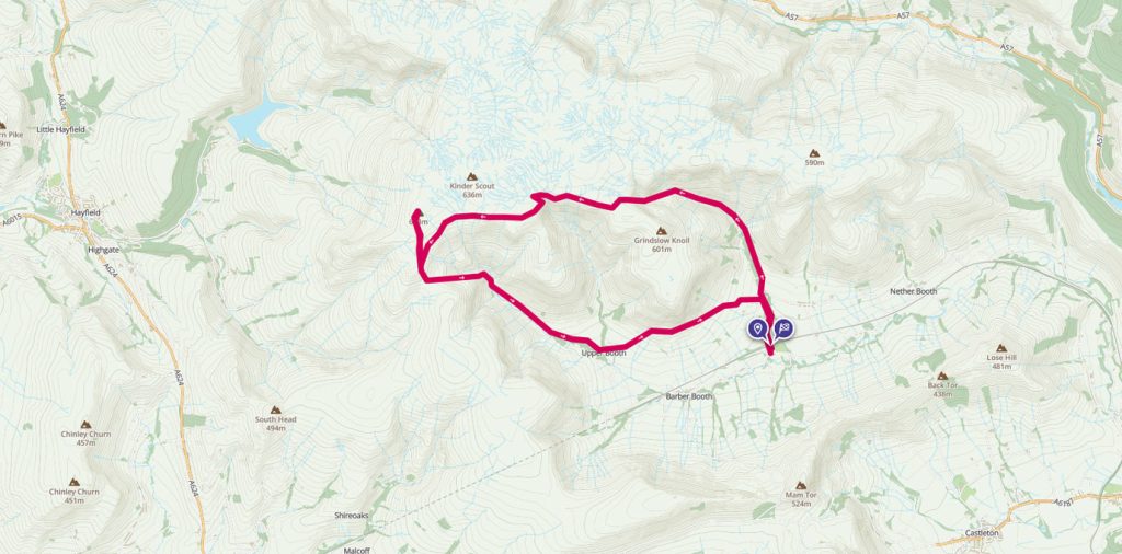
Kinder walk from Edale
In middle England we are blessed to have a huge range of walking opportunities available to us, and the Peak District is an excellent place to start if you have not explored this area before. One of my favourite places to head for hill walk is Edale, where the famous Pennine Way starts/finishes, and where you have easy access to Kinder Scout, Mam Tor, and a huge number of other walks with great views.
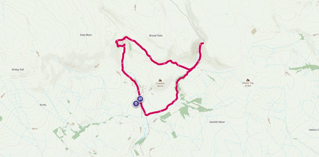
Magical Malham walk
It’s busy in the summer but busy for a reason. This short walk packs a lot in; take in part of the Pennine Way National Trail, cross the stunning limestone pavement of Malham Cove, marvel at the enormity of Gordale Scar and get whisked away by the magical Janet’s Foss.
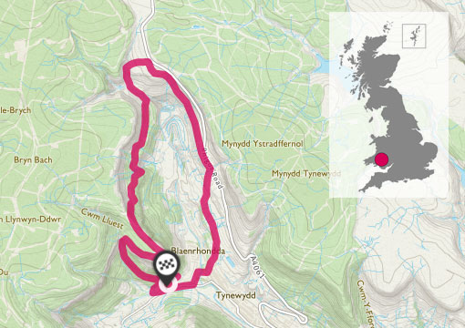
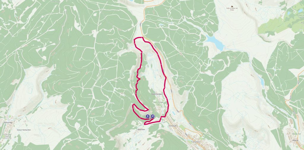
Circular walk around Pen-Pych Mountain
Pen-pych sits at the head of the Rhondda Fawr Valley in South Wales, Rhondda Valley’s very own Table Mountain. Experience the spectacular views of Pen-pych circular walk. This is such a varied walk, which is steeped in history. It passes by some large dramatic waterfalls, two of which are Nant Carnfoesan and Nant Melyn. You can visit an Iron Age settlement of hut circles, views of a former colliery and an old disused railway tunnel.
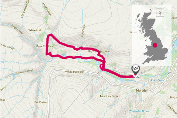
Piper Holes, Marsden
Piper holes provides a gentle 3-mile walk to the head of the Colne Valley. It provides some fantastic views across the wild and rugged landscape of the Marsden Moors and passes the historic Stanedge canal tunnels. It is well sign posted with Marsden Walkers are Welcome signs.
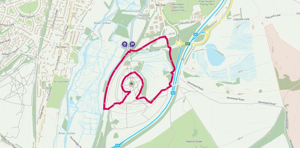
St Catherine’s Hill, Winchester
Topped with the remains of an iron-age fort, this short walk just outside Winchester gives great views across the area.